Maneh Kotikian


© Maneh Kotikian
Last updated: November 2015

Nevada

Past Research
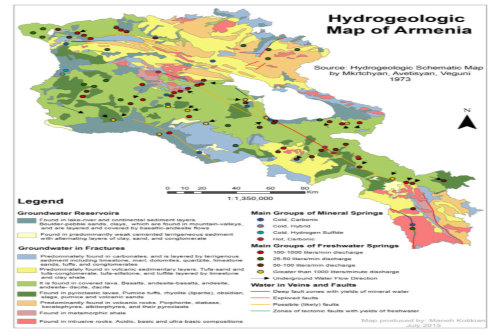
Hydrogeology and Surface Water Contamination Mapping, Armenia
This past summer, I spent time volunteering at the American University of Armenia at the Acopian Center for the Environment and Center for Responsible Mining working with the director, Alen Amirkhanian. My internship goals were to create a map of the geohydrology of Armenia based on Soviet data and to create a map of river pollution with state data to find the source and pathways of contaminants. Modern geohydrologic measurements in Armenia are extremely limited. However, the importance of creating these maps and analyzing contaminant sources from available land use and remote sensing data was clear due to the diminishing clean, freshwater resources. Experiencing firsthand the importance of hydrologic data provides intense motivation to become an expert in this field to continue to help communities abroad and at home solve water-resource related problems.Reconstructing the Anthopocene and Holocene Stratigraphic History of
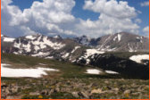
Fourmile Canyon, CO
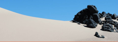
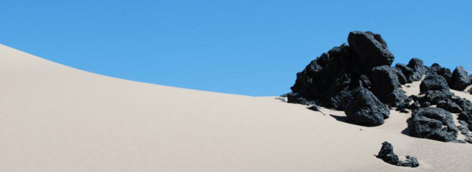
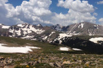
The summer leading to my senior year, I participated in Dr. David Dethier (Williams College) and Dr. Will Ouimet’s (University of Connecticut) Keck undergraduate research internship studying Fourmile Canyon in the Front Range outside Boulder, Colorado. During the month of fieldwork spent at the University of Colorado’s Mountain Research Station at Niwot Ridge, I designed a research project and created a plan to collect the data I needed while helping other students with their projects. My purpose was to reconstruct the Holocene and Anthropocene history of the canyon fill as well as the frequency of wildfires and floods using the exposed stratigraphy in Fourmile Canyon. I used LiDAR images to find cut banks from the 100-year flood that occurred in 2013 that exposed the stratigraphy. I took samples of charcoal and significant sediment deposits from multiple outcrops to reconstruct the fire history using C-14 dating and to do grain size analyses of the sediment to compare stratigraphic history in outcrops. I analyzed my results independently and with collaborations with Dr. Dethier, Dr. Ouimet, and Dr. Alan Werner (Mount Holyoke College). My conclusions showed the canyon fill is young indicating either the old sediment does not exist and was eroded away or it was not found however, due to exposed bedrock in the creek it was more likely eroded. Due to intermingling of slope deposits and fluvial deposits at one locality, changes in fluvial energy are recorded in stratigraphic history as is the fire occurrence record and evidence of severity. Relating to the Anthropocene, I concluded that Anthropogenic related erosion is accelerating natural slope processes. My project was a part of a greater research effort to understand human impacts and hillslope sediment mobilization in Fourmile Canyon. I completed this project as my undergraduate honors thesis titled, “Reconstructing the Holocene and Anthropocene stratigraphic history in Fourmile Canyon, Colorado”. I presented my research at Mount Holyoke College’s Senior Symposium as well as at the annual Keck symposium in the form of a presentation and poster. This research opportunity instilled independent planning, research and critical thinking skills in the field and at my home institution. This project confirmed my interests in geological research, made me a comprehensive geologist, and validated my desire to pursue graduate studies. By working with advisors who are supportive but not excessively involved and creating my own deadlines for lab work and thesis completion, I have become a responsible, self- motivated geologist.
Click on the image to learn
more about Armenia’s
hydrogeology!
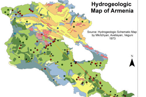 I digitized this map from the original
paper copy. It is the only map of
hydrogeology in this country that has
been digitized!
I digitized this map from the original
paper copy. It is the only map of
hydrogeology in this country that has
been digitized!

Undergraduate Thesis
 Reconstructing the Anthropocene and
Holocene Stratigraphic History of
Fourmile Canyon, CO
Reconstructing the Anthropocene and
Holocene Stratigraphic History of
Fourmile Canyon, CO


Maneh Kotikian

© Maneh Kotikian
Last Updated: November 2015

Past
Research
Hydrogeology and
Surface Water
Contamination
Mapping, Armenia
This past summer, I spent time volunteering at the American University of Armenia at the Acopian Center for the Environment and Center for Responsible Mining working with the director, Alen Amirkhanian. My internship goals were to create a map of the geohydrology of Armenia based on Soviet data and to create a map of river pollution with state data to find the source and pathways of contaminants. Modern geohydrologic measurements in Armenia are extremely limited. However, the importance of creating these maps and analyzing contaminant sources from available land use and remote sensing data was clear due to the diminishing clean, freshwater resources. Experiencing firsthand the importance of hydrologic data provides intense motivation to become an expert in this field to continue to help communities abroad and at home solve water-resource related problems.Reconstructing
the Anthopocene
and Holocene
Stratigraphic
History of
Fourmile Canyon,
CO
The summer leading to my senior year, I participated in Dr. David Dethier (Williams College) and Dr. Will Ouimet’s (University of Connecticut) Keck undergraduate research internship studying Fourmile Canyon in the Front Range outside Boulder, Colorado. During the month of fieldwork spent at the University of Colorado’s Mountain Research Station at Niwot Ridge, I designed a research project and created a plan to collect the data I needed while helping other students with their projects. My purpose was to reconstruct the Holocene and Anthropocene history of the canyon fill as well as the frequency of wildfires and floods using the exposed stratigraphy in Fourmile Canyon. I used LiDAR images to find cut banks from the 100- year flood that occurred in 2013 that exposed the stratigraphy. I took samples of charcoal and significant sediment deposits from multiple outcrops to reconstruct the fire history using C-14 dating and to do grain size analyses of the sediment to compare stratigraphic history in outcrops. I analyzed my results independently and with collaborations with Dr. Dethier, Dr. Ouimet, and Dr. Alan Werner (Mount Holyoke College). My conclusions showed the canyon fill is young indicating either the old sediment does not exist and was eroded away or it was not found however, due to exposed bedrock in the creek it was more likely eroded. Due to intermingling of slope deposits and fluvial deposits at one locality, changes in fluvial energy are recorded in stratigraphic history as is the fire occurrence record and evidence of severity. Relating to the Anthropocene, I concluded that Anthropogenic related erosion is accelerating natural slope processes. My project was a part of a greater research effort to understand human impacts and hillslope sediment mobilization in Fourmile Canyon. I completed this project as my undergraduate honors thesis titled, “Reconstructing the Holocene and Anthropocene stratigraphic history in Fourmile Canyon, Colorado”. I presented my research at Mount Holyoke College’s Senior Symposium as well as at the annual Keck symposium in the form of a presentation and poster. This research opportunity instilled independent planning, research and critical thinking skills in the field and at my home institution. This project confirmed my interests in geological research, made me a comprehensive geologist, and validated my desire to pursue graduate studies. By working with advisors who are supportive but not excessively involved and creating my own deadlines for lab work and thesis completion, I have become a responsible, self- motivated geologist.
Click on the
image to learn
more about
Armenia’s
hydrogeology!
 I digitized this map
from the original
paper copy. It is the
only map of
hydrogeology in this
country that has
been digitized!
I digitized this map
from the original
paper copy. It is the
only map of
hydrogeology in this
country that has
been digitized!

Undergraduate
Thesis
 Reconstructing the
Anthropocene and
Holocene
Stratigraphic History
of Fourmile Canyon,
CO
Reconstructing the
Anthropocene and
Holocene
Stratigraphic History
of Fourmile Canyon,
CO