Store
Cupidatat voluptate
Ut adipisicing, in cillum cupidatat voluptate esse
$0.00

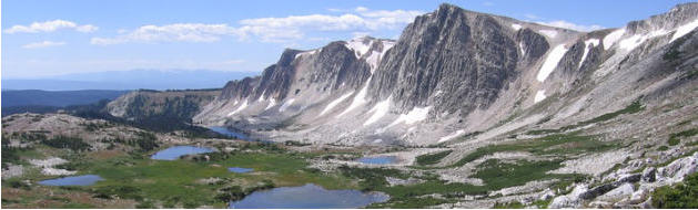
Hydrologic flow paths in an alpine catchment:
Investigations with time-lapse electrical resistivity tomography (ERT)
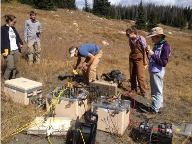
My primary project is focuses on a time-lapse ERT survey on hill slope in the Medicine Bow National Forest west of Laramie, at about
9,500 ft elevation. We hand-made cables integrated with electrodes and deployed them just in time before winter set in. We monitored
sub-surface variations in conductivity through the winter and spring to learn about the movement of water through the soil and bedrock
on this steep hillside, and are integrating the subsurface hydrologic data with sap-flow sensor that measure evapotranspiration in the
conifer trees. Seismic velocities gathered in the summer help us constrain bedrock depth. This research is ongoing, and is being
presented at the American Water Resources Association (AWRA) conference (November 2015) and the American Geophysical Union
(AGU) fall meeting (December 2015).
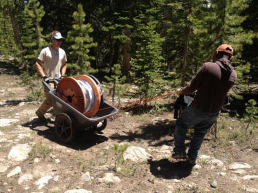
Research:
As a part of WyCEHG I am involved in various geophysical investigations of hydrology in Wyoming. My research group utilizes surface
Nuclear Magnetic Resonance (NMR), Electrical Resistivity Tomography (ERT), Ground Penetrating Radar (GPR), Distributed Temperature
Sensor (DTS), and other geophysical and hydrologic tools to investigate wildland hydrology
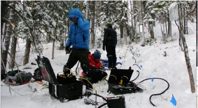

Measuring stream temperature with fiber-optic Distributed Temperature Sensor
In summer 2014 we deployed a fiber-optic temperature monitoring technology called Distributed Temperature Sensor (DTS) in the No-Name drainage
in the Medicine Bow National Forest. DTS works on the principle that the optical properties of a fiber-optic cable change with temperature. A laser
sends light pulses down a protected fiber and a sensor records any changes in the character of the light pulse, then back-calculates temperature at
every meter along the fiber, which can be several kilometers long. This provides very high spatial resolution, un-paralleled in other environmental
sensing technologies.
The high spatial resolution of DTS, with measurements every meter along 550 m of stream, allowed us to monitor the No-Name Creek and look for
temperature signals that indicate exchange with groundwater. It was an arduous deployment requiring many WyCEHG volunteers, but once set up,
the autonomous DTS system collected data every ten minutes for 16 days without a hitch. The rich temporal and spatial temperature data we
collected allows us to identify zones of groundwater exchange, and investigate the stream’s response to solar radiation and the ambient environment.

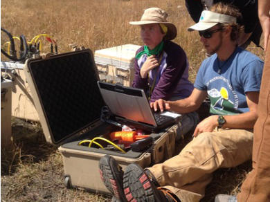
Surface NMR in the Snowy Range
We measure Nuclear Magnetic Resonance to take an "MRI" of the shallow-subsurface. This hydro-geophysical method is unique in that it makes an
un-ambiguous measurement of water content, to depths of 30 - 60 meters.


Drew Thayer
Hydrogeophysics
Water Resources
University of Wyoming